GEOFRAME / WHO IT'S FOR AND PRICING

Who GeoFrame is for.
Anyone who has to show a place before it changes.

GeoFrame turns public data into a measured 3D model of a real neighborhood, right in the browser. Planners, architects, marketers, teachers, tourism boards and neighbors use it to show what a place looks like now, and what a proposal would really look like on those streets.

USE CASES / SIX KINDS OF TEAMS

One real place in 3D.
Six ways to put it to work.

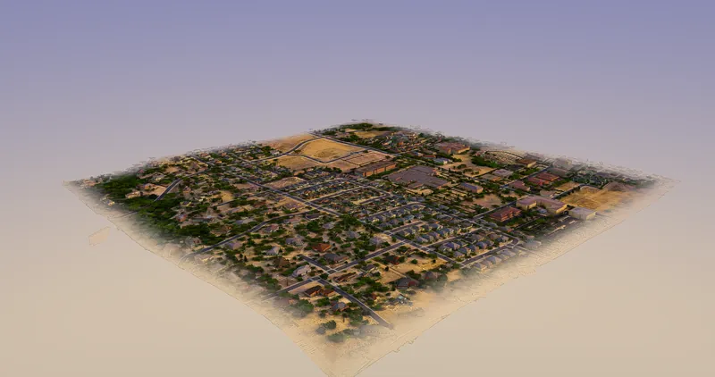
Downtown Templeton modelled in GeoFrame, buildings and streets in 3D
01 / PUBLIC SECTOR

City and county planning departments and councils

Show residents a proposed project on the streets they actually walk, before the hearing.

  • Drop a proposed building into the real block for a public workshop
  • Add views and sun studies to staff reports and council packets
  • Embed the model on the city website so residents can look for themselves

Best fit: Government, with a 90-day pilot for $1,500
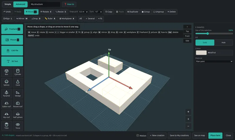
A CAD model imported into its real surroundings in GeoFrame
02 / DESIGN

Architects and developers

Study massing in real context, measured from LiDAR rather than guessed.

  • Test massing options against the neighbors' real heights
  • Check sight lines, sun and shadow from the street
  • Export renders for clients and the planning file

Best fit: Pro or Team; Project Pass for a single site

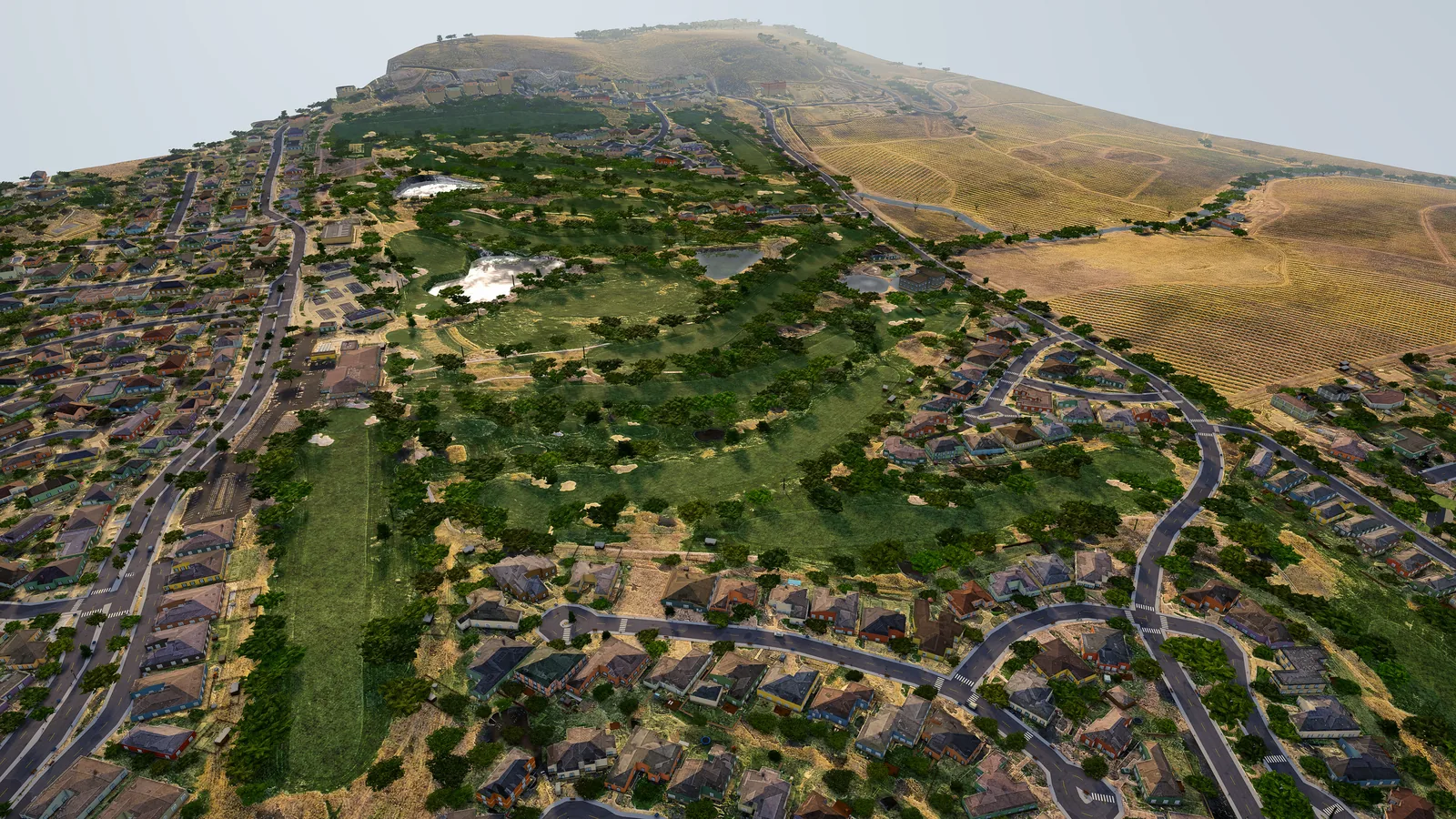
Homes, streets and fairways at the San Luis Obispo Country Club, rendered in GeoFrame from open data
03 / MARKETING

Real-estate marketers

Sell the neighborhood along with the listing.

  • Place a listing or new development in its real surroundings
  • Make a flyover video for the listing page and social posts
  • Share a link buyers can explore on a phone

Best fit: Project Pass per development, or Pro for an agency

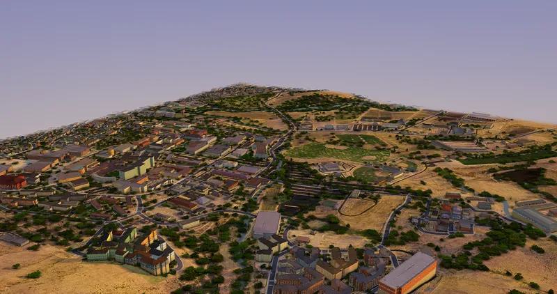
A university campus modelled in GeoFrame
04 / EDUCATION

Teachers of civics, geography and urban planning

Students model their own town, in a browser, with no workstation lab.

  • Students propose a park, a bike lane or housing on streets they know
  • Read terrain, streets and building heights in 3D
  • Present projects the way a planning commission sees them

Best fit: Education, free for classes

05 / VISITORS

Tourism boards and chambers of commerce

Flyover clips of downtowns and coastlines, made from the real place.

  • Make flyovers of Main Street, the waterfront and the coast
  • Show visitors the town from the air before they arrive
  • Cut clips for visitor guides, websites and social posts

Best fit: Pro, or a Project Pass per campaign

06 / NEIGHBORS

Community groups

Show what a proposed project would really look like, before you speak at the meeting.

  • Model the proposal at its stated height on the real block
  • Show the view from your street, porch or park
  • Share one link with neighbors and the press

Best fit: Project Pass, or a month of Pro

WHICH PLAN FITS / AT A GLANCE

Find your row.
That's your plan.

If you are…Start withWhy
A city or county planning department or councilGovernmentUnlimited staff seats, the whole jurisdiction kept current, a public embed. 90-day pilot for $1,500, credited in full.
An agency that keeps data in-houseOn-premisesRuns on your own server; no data leaves your network.
An architect or developerPro · TeamPro per designer; Team when five people share areas and client links.
A real-estate marketerProject Pass · ProOne pass per development, or Pro for an agency with steady listings.
A teacher or schoolEducationFree for classes; $1,000 a year for a department lab.
A tourism board or chamber of commercePro · Project PassImage and video export for flyovers; a pass for a one-off campaign.
A community groupProject PassOne site, a public link hosted for 90 days, no subscription.

PRICING / PLANS FOR EVERY TEAM

Start with Pro.
Grow into a team, a city or your own server.

PRO

Pro

$79 / seat / month

or $790 per seat a year

  • Unlimited Open Data areas
  • 5 premium builds a month
  • Creator 3D editor
  • AI assistant
  • Owner lookup
  • Image and video export
  • Share links
Open GeoFrame ↗
PROJECT PASS

Project Pass

$499 / project

One-off, per project

  • One premium area around the site
  • Creator for the project team
  • Public link hosted 90 days
  • No subscription
Book a demo →
GOVERNMENT · HOSTED

Government

$6,000–$15,000 / year
  • $6,000 small city · $10,000 mid-size city · $15,000 county
  • Unlimited staff seats
  • All areas in the jurisdiction kept current
  • Public embed for the city website
  • A training session
  • 90-day pilot for $1,500, credited in full on conversion
Ask about a pilot →
ON-PREMISES

On-premises

from $12,000 / year
  • Runs on your own server
  • No data leaves your network
  • Signed offline license
  • Install and training included
Request a license →
EDUCATION

Education

Free for classes
  • Free for classes
  • $1,000 a year for a department lab
  • Creator for students and staff
Ask about education →

Extra premium builds are $15 each. Prices in USD. Pro and Team are billed through Stripe and can be cancelled any time. Government, on-premises and education plans are invoiced net 30.

QUESTIONS / BEFORE YOU BUY

Straight answers.

Can I cancel?

Yes. Pro and Team are billed through Stripe and can be cancelled any time. A Project Pass is a one-off payment with no subscription. Government, on-premises and education plans are invoiced net 30 on an annual term.

What is measured and what is estimated?

Terrain and building heights are measured by USGS 3DEP LiDAR, and building outlines and streets are where OpenStreetMap maps them. What the data can't see, such as a rear wall, a roof shape or a missing height, is estimated, and the app labels it as estimated.

Can we keep our data on our own server?

Yes. The on-premises license installs GeoFrame as one Debian package on your own server, with a signed, seat-based offline license. No data leaves your network, and install and training are included.

Who qualifies for Education?

Teachers and students using GeoFrame for a class get it free. A school or university department that wants a shared lab pays $1,000 a year. Ask about education and tell us your school and course.

SEE YOUR OWN TOWN

Book a demo with your address.
Or try your own town.